


Logan Township Voting District, Lincoln County, Kansas
About
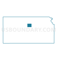
Outline

Summary
| Unique Area Identifier | 585679 |
| Name | Logan Township Voting District |
| County | Lincoln County |
| State | Kansas |
| Area (square miles) | 35.80 |
| Land Area (square miles) | 35.68 |
| Water Area (square miles) | 0.12 |
| % of Land Area | 99.67 |
| % of Water Area | 0.33 |
| Latitude of the Internal Point | 39.08053350 |
| Longtitude of the Internal Point | -97.98695110 |
Maps


Graphs
Select a template below for downloading or customizing gragh for Logan Township Voting District, Lincoln County, Kansas


Neighbors
Neighoring Voting District (by Name) Neighboring Voting District on the Map
- Beaver Township Voting District, Lincoln County, KS
- Colorado Township Voting District, Lincoln County, KS
- Elkhorn Township Part A Voting District, Lincoln County, KS
- Fountain Township Voting District, Ottawa County, KS
- Henry Township Voting District, Ottawa County, KS
- Morton Township Voting District, Ottawa County, KS
- Salt Creek Township Voting District, Lincoln County, KS
Top 10 Neighboring County Subdivision (by Population) Neighboring County Subdivision on the Map
- Elkhorn township, Lincoln County, KS (929)
- Morton township, Ottawa County, KS (463)
- Beaver township, Lincoln County, KS (425)
- Colorado township, Lincoln County, KS (289)
- Fountain township, Ottawa County, KS (157)
- Logan township, Lincoln County, KS (68)
- Salt Creek township, Lincoln County, KS (63)
- Henry township, Ottawa County, KS (27)
Top 10 Neighboring Unified School District (by Population) Neighboring Unified School District on the Map
- North Ottawa County Unified School District 239, KS (3,483)
- Twin Valley Unified School District 240, KS (2,583)
- Lincoln Unified School District 298, KS (2,463)